Guides
How to keep a roadside architecture field guide that lasts
Roadside architecture field guide for 2027 shows how to read, photograph, and describe motels, stations, signs, and roadside places with care.
A roadside architecture field guide gives you a practical way to notice what an automobile-oriented place is doing. Useful for a former filling station, motel court, diner, drive-in, or tourist cabin. Also helps with a neon sign, roadside park, or small commercial strip.
The goal is not to decide a place is historic from the sidewalk, but to make a clear, dated record of what you can see and separate observation from research, memory, and opinion.
What to take away
- Start with the setting, route, and point of approach before focusing on a building detail.
- Describe visible materials, signs, circulation, and alterations without guessing at an original date or architect.
- Take overview, approach, elevation, detail, and context photographs with one consistent naming system.
- Keep a question list for records research instead of turning a first visit into a preservation claim.
- Ask the owner before entering private property, flying a drone, or using a photo that needs permission.
What belongs in roadside architecture
Roadside architecture is a plain-language category for places made to be noticed, reached, or used from a road. The building may be modest.
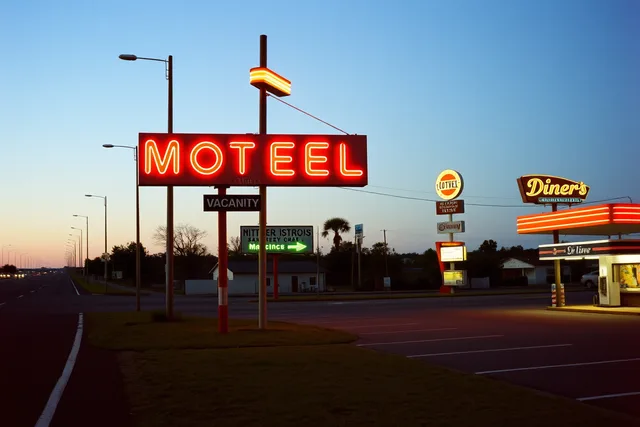
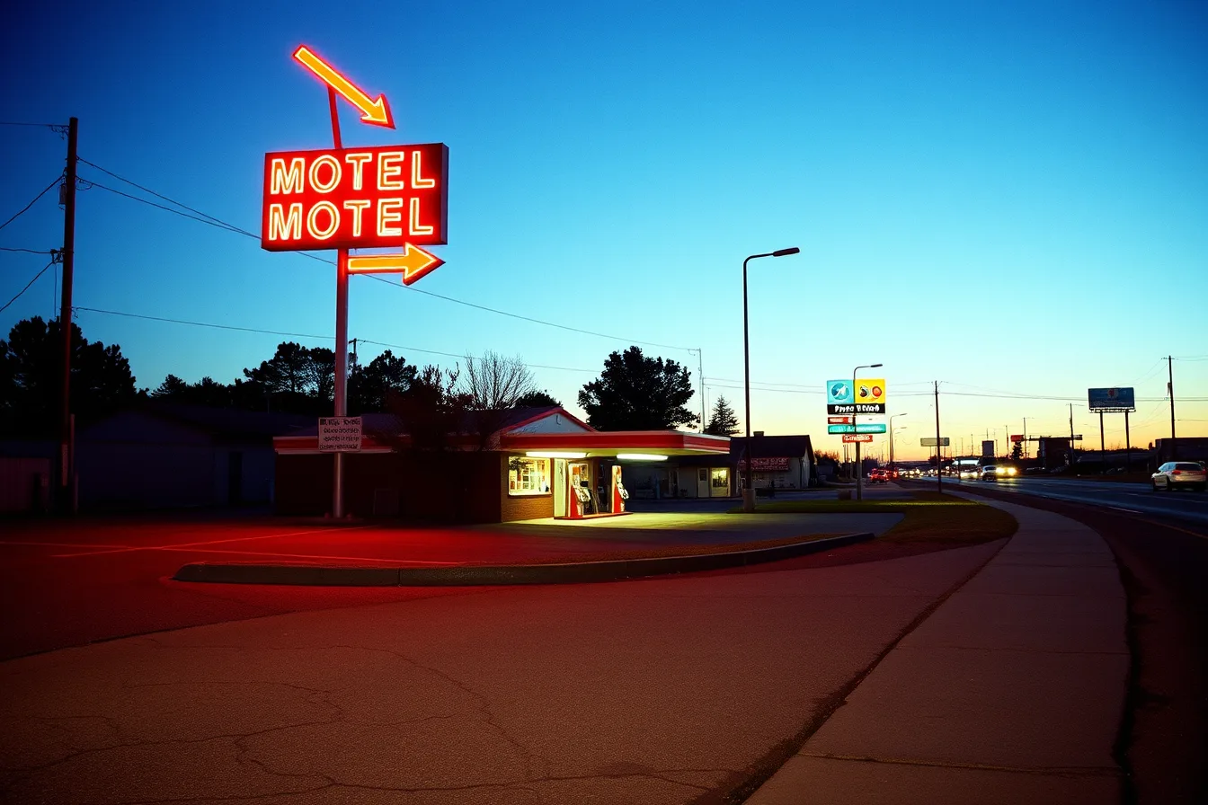
The interest is the relationship among the facade, parking area, sign, and curb cut. The driveway, view, and travel direction matter too. A motel sign high enough for a driver to read, a gas station canopy facing an approach lane, and a cafe with a prominent corner entrance all tell part of the story.
Treat that relationship as a field observation, not as a conclusion about significance. The National Park Service discusses cultural-resource documentation through land use, vegetation, circulation, and structures (Read the NPS planning overview).
That source concerns park planning, but for a local roadside place, the useful lesson is narrower: record surrounding features that affect how the site is seen and used.
| What to notice | A practical description | Avoid writing |
|---|---|---|
| Arrival | Direction of travel, driveway position, parking pattern | "This was the original entrance" without a record |
| Building form | One story or more, roof shape, wall materials, additions | A style label based only on a quick glance |
| Signage | Location, scale, wording, condition, lighting if visible | A claim that a sign is original without evidence |
| Road relationship | Setback, visibility, curb, shoulder, neighboring uses | A claim that the road alignment never changed |
| Setting | Lots, trees, views, utility lines, nearby development | A claim that every feature is historic |
Begin with a repeatable walk-around
Make one pass from the public right-of-way if that is where you are allowed to stand. Note the address or approximate location, date, time, weather, and viewing direction. Then write what you saw before looking up a history online. This protects the record from being shaped by a popular story you may later find.
Use the same sequence at every stop:
- Photograph the site in its road setting.
- Photograph the approach a driver or pedestrian would use.
- Record each visible elevation from a lawful position.
- Note signs, service areas, paved surfaces, and small features.
- End with a short list of questions for later research.
Do not assume that a weathered feature is old or that a freshly repaired feature is new. Paint, signage, roof material, and paving can change at different times. A visible seam, blocked opening, or odd roofline is a useful observation. It becomes a historical claim only when a record supports it.
Describe a place in layers
A strong field note moves from large to small. First establish the route and surroundings. Then describe the building mass and layout. Last, list the details that may deserve a closer photo or source check. This order makes a later article easier to follow because readers can picture the site before meeting a technical term.
Layer one: Route and setting
Write down the roadway name shown on a current sign, not the route name you expect to find. Describe whether the property sits beside a through road, frontage road, town street, intersection, or parking lot. Mention only the setting you can see: broad shoulder, mature trees, nearby commercial lots, vacant parcels, or a close group of older storefronts.
Layer two: Movement and use
See how people and vehicles enter, stop, and leave, and note a building facing one road while its active entrance faces a side lot.
A long facade can be more visible from the road than the door, and patterns reveal more than a decorative detail. Do not cross a barrier to improve a photo; put the limitation in the note.
Layer three: Fabric and detail
Use direct words for what you see: brick, stucco, painted block, metal panel, wood siding, glass block, tile, stone, wood trim, or a projecting canopy. If a material is hidden by paint, say that. If you cannot tell whether a surface is original, say that too. The record becomes more credible when it has room for uncertainty.
| Field-note phrase | Why it works |
|---|---|
| "A low, flat-roofed wing extends behind the main sign" | It reports a visible condition |
| "The east-facing facade has three boarded openings" | It gives location and count |
| "A curb cut appears on the north side" | It avoids stating its date or purpose |
| "The sign is partly obscured by a tree from the roadway" | It records a current viewing condition |
Photograph for context, not just charm
One attractive detail photo is rarely enough. Make a small set that lets another person understand where it belongs. A useful set usually includes a wide view from the public route, an approach view, one straight-on facade view, two detail views, and a context view showing neighboring development or surroundings.
Keep the original image files, not just social-media exports. Use a filename that includes a place label, date, sequence, and view direction. For example, northside-motel_2027-06-14_03_south-facade.jpg is easier to understand than IMG_3287.jpg. If a photograph is edited for brightness or cropping, keep the unedited file as well.
The photo record should not manufacture drama. Avoid a tight crop that makes a place appear isolated when a busy strip is immediately beside it. Avoid moving objects or adding a vintage filter. A field guide is more valuable when its pictures explain the present condition honestly.
Separate a field observation from research
Fieldwork answers "what is visible today?" Research answers different questions: who built the property, when a sign changed, how a road was rerouted, whether a structure is listed, or what prior alterations occurred. Keep these categories in separate columns or separate files.
Your field notes do not need to imitate a formal documentation program. The useful discipline is to label a photograph, a measured observation, and researched history as different kinds of evidence. Keeping those labels separate makes it harder for a later edit to turn a first impression into a documented fact.
The Library of Congress describes HABS, HAER, and HALS records as a combination of drawings, photographs, and written histories. Review the Library of Congress note on documentation. An informal field guide is not formal documentation, but it benefits from keeping images, notes, and later research distinct.
| Statement in a draft | Evidence label that fits |
|---|---|
| "The canopy extends over two visible pump islands" | Field observation, dated |
| "A 1940 map labels the parcel as a service station" | Map, date, repository, and citation |
| "A longtime resident recalls a cafe at the site" | Attributed recollection with permission |
| "The business was founded in 1940" | Only use after finding a supporting record |
Build a compact field record
You do not need a complicated database. A simple record can have five sections: place identification, visit details, observations, photo log, and research questions. The important part is that every entry can be understood later by someone who was not there.
Use this checklist on a phone, clipboard, or notes app:
- Location as shown on current maps or a street sign
- Date, time, visitor name or initials, and lawful observation point
- Current use if visible, or "use not confirmed"
- General building form and visible materials
- Signs, circulation features, surrounding elements, and changes that are visible
- Photo filenames with a one-line description of each view
- Questions that need records, an owner conversation, or a local archive
Do not add a private phone number, vehicle plate, security detail, or personal information to a public article. A field record can be useful without exposing someone else's private information.
The NIST Privacy Framework is a voluntary privacy-risk resource. It supports considering whether an image, observation, or record detail is needed for the article and handled through established practices. It does not provide permission to access private land or publish private material.
Make your writing useful to future readers
The best roadside architecture writing gives a reader enough context to look again. It does not turn every roadside business into a landmark, and it does not use a date or style label as decoration. Tell readers what you observed, what a source confirms, and what remains unknown.
When a place is actively used, respect that fact. A working motel, restaurant, repair shop, or station is not a museum set. Your article may discuss its visible design and public history, but it should not encourage trespass or treat employees and owners as props in a story.
The National Archives describes records management as a lifecycle including creation, maintenance, use, and disposition. Read the National Archives basic records-management concepts. Preserve field notes and later research as dated records so an update does not rewrite what was observed on the original visit.
Common questions
Is roadside architecture only about Route 66?
No. Route 66 has many well-known examples, but roadside architecture can be found along town streets, parkways, highways, and older commercial roads throughout the United States.
Can I call a building historic after one visit?
No. Record what you see, then find reliable records before making a claim about date, authorship, designation, or historical importance.
May I photograph a roadside building from any location?
Use a lawful public location unless you have permission. Do not enter private land, block a driveway, or create a traffic hazard for a better picture.
In this guide
- Roadside architecture survey checklist: how to record a site on your first visitRoadside architecture survey checklist for 2027 helps writers make a clean first-visit record of setting, route access, visible features, and photos.
- Roadside architecture feature questions to ask before you write a captionRoadside architecture feature questions for 2027 help readers investigate signs, canopies, parking, facades, and route relationships without overclaiming.
- How to build a roadside architecture cost record guide that holds upRoadside architecture cost record guide for 2027 explains how to track scope, estimates, approvals, and changes without presenting a generic price as a fact.
- Roadside architecture preservation warnings: what to check before your project moves aheadRoadside architecture preservation warnings for 2027 identify common evidence, safety, access, and scope mistakes before an article or project moves ahead.
- How to build a roadside architecture site record guide that lastsRoadside architecture site record guide for 2027 shows how to organize images, observations, sources, permissions, and updates for a clear publication file.