Guides
Part of How to build a roadside architecture research plan before you start fieldwork
How to review a roadside architecture map before you publish
Roadside architecture map review guide for 2027 explains how to compare historic maps, read symbols, track editions, and state map evidence without overclaiming.
A historic map is useful because it captures what its maker chose to record at a stated time. That is a narrower claim than saying a map proves a building's construction date, tenant, or condition. This guide gives editors a repeatable way to review map evidence before using it in a roadside architecture story.
What to take away
- Record the title, edition, date, scale, and repository before comparing anything.
- Match a route by more than one clue, such as a junction and a watercourse, because road names and alignments can change.
- Read a symbol through the map's own legend or symbol guide. A blank spot is not proof that a building was absent.
- State what the sheet shows, then use a photograph, directory, survey form, or record for claims the sheet cannot establish.
Give every map an identity card
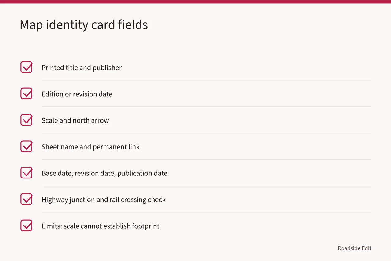
Begin with border information. Note the printed title, publisher, edition or revision date, scale, and north arrow. Then note the sheet name and permanent item link.
Save a full image or PDF and the clipped area you may later use in a draft. A crop can help a reader, but it strips away information others need to check the result.
The date needs special care. A map may carry a base-compilation date and a later revision or reprint date.
The U.S. Geological Survey explains that sheets with the same date can differ through revisions and reprints, and the map collar may hold additional dates. Check USGS guidance on distinguishing historical map editions. Record all dates that appear, not the one that best fits a story.
Use a short entry like this in your research notes:
| Field | Example note |
|---|---|
| Sheet identity | Printed title, series, and repository item URL |
| Dates | Base date, revision date, and publication date if shown |
| Location check | Highway junction and rail crossing match the subject area |
| What appears | Road alignment, labeled service station, or building mark |
| Limits | Scale cannot establish the exact footprint or occupancy |
Read the scale and symbols before making a claim
Maps simplify. A building may appear as a point, a small square, a general built-up area, or not at all.
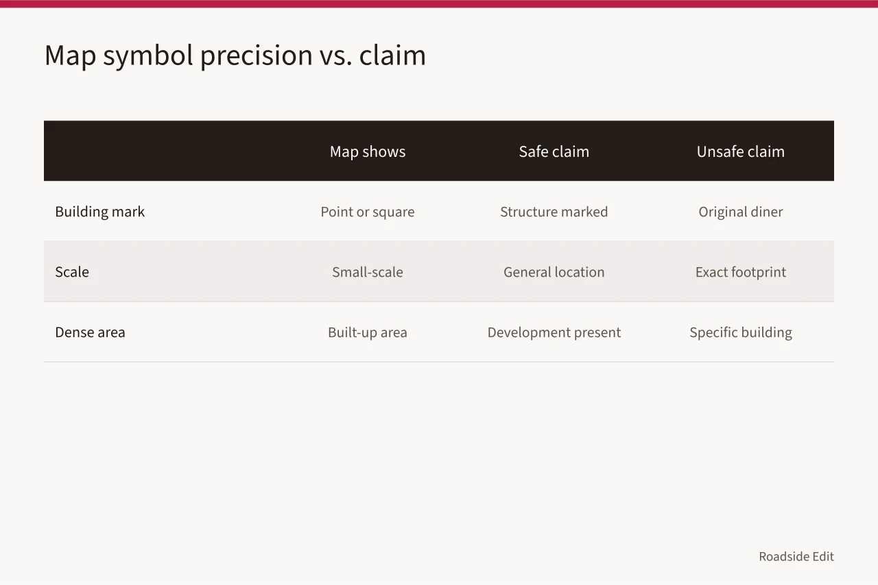
The treatment depends on map type, its scale, the available room, and the cartographic choices made for that edition. The USGS guide to topographic map symbols explains features can appear as points, lines, or areas, and dense development may omit individual buildings. That directly affects how much can be said about a roadside property.
Write the conclusion at the same level of precision as the source. "A structure is marked beside the highway" is a defensible observation when the mark is clear. "This is the original 1930 diner" is not. That second statement needs a record that identifies the building and connects it to the date or business.
Compare one place across time
Start by marking a stable reference point on each sheet. A bridge, a rail crossing, a river bend, or an intersection is usually more dependable than a business name. Put the sheets side by side before trying an overlay. Ask whether they cover the same area, use comparable scale, and show the same road segment.
The USGS Historical Topographic Map Collection has scanned maps published from 1884 to 2006. Its collection page notes a map sequence can show a place at different points in time. Use the USGS historical map collection as a date-bounded comparison source.
A sequence can support a careful statement about a route, stream, or mapped built area changing between named editions. It does not turn an absent symbol into proof of absence on the ground.
Do not force a modern satellite image to line up perfectly with a historic sheet. Reprojection, scanning, road construction, and map generalization all introduce differences. In a published article, say "the 1954 sheet places the route in this corridor" when that is what the sheet supports. Readers can understand a well-bounded finding.
Keep a claim log beside the map
The cleanest workflow separates observations from conclusions. First, list the visual facts. Then state the inference, if any. Finally, list the independent source needed to check it. This prevents a persuasive caption from becoming more certain than the underlying evidence.
| Map observation | Safe wording | What to find next |
|---|---|---|
| Road is drawn farther east on the earlier sheet | "The earlier map shows the road east of its later alignment." | Transportation record or dated aerial image |
| Building symbol appears at the site | "A building mark appears at this location." | Survey form, photograph, or assessor record |
| Name label changes | "The label changes between these editions." | Directory, newspaper, or official naming record |
| No feature is marked | "The sheet does not mark a feature here." | Another map or ground-level documentation |
National Park Service survey guidance recommends keeping a copy of maps prepared from archival research, so pre-fieldwork expectations can be compared with field results. It also calls for a clear identifier linking a map mark to the form describing the property. Read the National Park Service guidance on organizing survey maps.
A small claim log follows the same practical idea: it preserves the path from image to statement.
Check the record before publication
Before publishing, open the stable item page again and check that the title, dates, and image still match your notes. If you downloaded a file from an archive, preserve its catalog identifier.
The National Archives keeps cartographic and architectural records as a separate research area, a useful reminder that a map can be both an image and a record with provenance. See the National Archives guide to cartographic and architectural records.
Then read each sentence that relies on the map. If the source does not show it, revise the sentence or add the source that does. This is usually a stronger article than one built on broad, attractive claims.
Common questions
Does a blank part of a historic map prove no building existed?
No. It may result from scale, source coverage, publication purpose, or a symbol choice. Say that the sheet does not mark a feature, then look for another source before making a negative claim.
Can an overlay establish an exact historic boundary?
Usually not by itself. Use it to identify a likely relationship between mapped features. Boundary or parcel claims need records that identify the parcel and date.
What should appear in a map citation?
Include the item title, publisher or creator, visible dates, sheet or catalog identifier, and the specific repository page. Keep the full map image with your research file.