Guides
Part of How to plan a roadside renovation that adapts to each region
How to build roadside renovation regional adaptation records that last
Build 2027 roadside renovation regional records that preserve source dates, local context, project limits, weather updates, handoffs, and public corrections.
Good regional records show the difference between context and conclusion. They preserve where a source came from, the scale it covers, when it was checked, and which local question still needs an answer. That information matters when a draft uses maps, climate data, agency updates, or a local project statement.
What to take away
- Keep the source, date, geographic scale, purpose, and limitation in one entry.
- Preserve earlier public wording when a newer record changes the story.
- Hand off local questions instead of stretching regional context into a result.
What must a regional source record show?
A regional record needs more than a link. It must tell the next reader what the source covers.
A map can cover a watershed, county, community, or parcel. A climate dataset can describe a station or larger reporting area. A local notice may apply only to a named work zone or period. Without that context, a later writer can accidentally turn a broad reference into a claim about one roadside property.
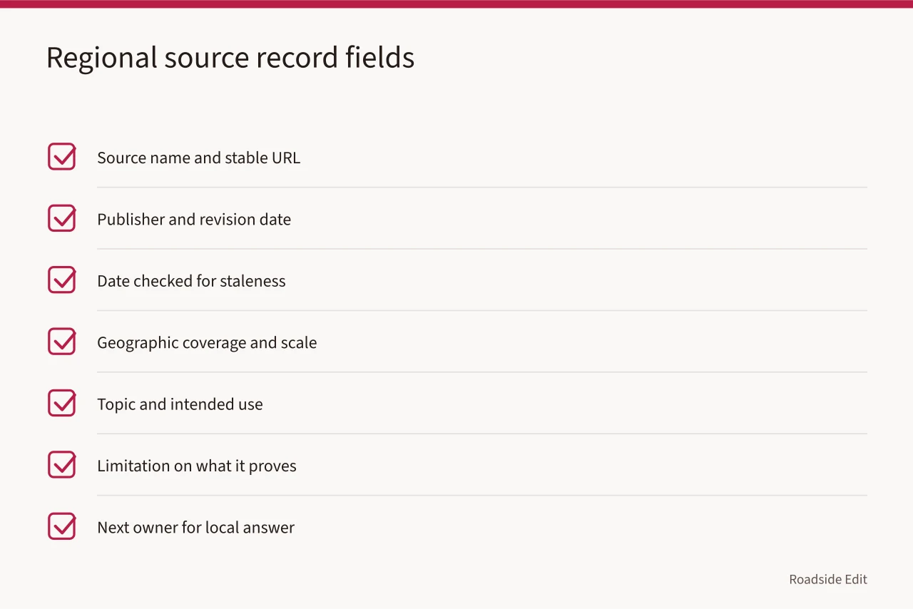
Begin with the source name, stable URL or file location, publisher, and publication or revision date. Add date checked, geographic coverage, topic, and intended use.
Add a clear limitation: a record can say: "This climate dataset provides regional long-term averages and is not a current forecast or a property performance report." A limitation keeps the record useful without sounding like a legal or technical determination.
| Field | Why it belongs in the record |
|---|
The U.S. Geological Survey describes InFRM as a flood-risk information effort for emergency planners, local governments, and other users that works at watershed scale. Review the USGS InFRM overview. It does not determine risk, permit status, or required work for a particular roadside property. It supports documenting scale and purpose before an article relies on flood-related context.
How do you record climate context?
Climate context should be stored as context, not as a prediction. Record the location or station reference used by the source, the period it summarizes, the measurement or category being cited, and the sentence it supports. Do not combine a long-term average with a current weather event in one unsupported statement.
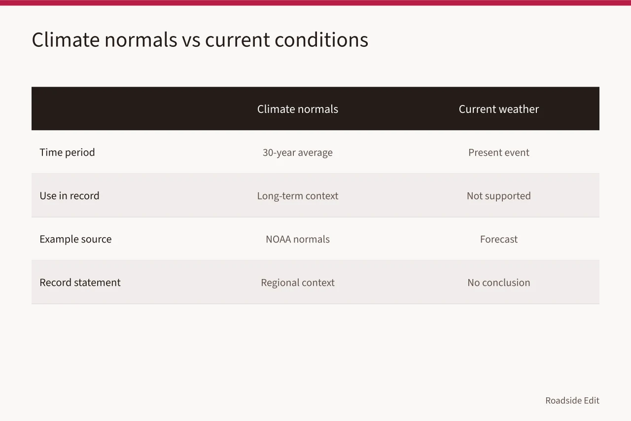
NOAA's U.S. Climate Normals are long-term averages calculated over a standard 30-year period. Read NOAA's U.S. Climate Normals overview. A source record can use this page to explain what the normals represent. It cannot use the same page to establish a present temperature, a future construction delay, or the condition of a site system.
A clean record might read: "NOAA climate normals, checked June 2027, used for long-term regional temperature context; no conclusion about current conditions or building performance."
Routine detail, but it stops a later editor from citing the source beyond its support.
How do you record mapped flood information?
Store a flood-related source with its exact map or community reference, access date, and purpose. State whether the article uses it to explain a general mapped-hazard concept, a community designation, or an official property-specific result.
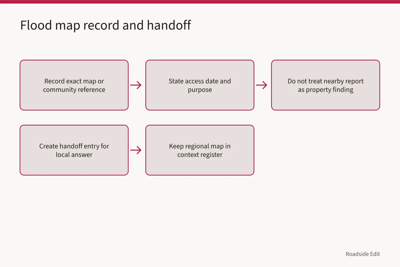
Do not record a nearby flood report as a property finding. Do not state a property lies outside a hazard area unless an appropriate current site-specific source says so.
FEMA explains that flood maps identify flood hazards and related risk information for communities. See FEMA's flood map information. That supports recording the map's publisher and community coverage. It does not establish present water conditions, property damage, insurance requirements, or a required renovation at a particular address.
When a local project needs a property answer, create a handoff entry. Include the question, date, source that raised it, responsible recipient, and the next record to obtain. A regional map may remain in the context register while the local answer is still pending.
How should a source change be logged?
When a new local plan, agency update, owner statement, or project record changes a draft, add a revision entry. Keep the earlier wording, new wording, source date, reviewer, and reason. This protects readers from quiet shifts in meaning and helps an editor see whether a regional statement became too specific over time.
Use an append-only approach. Add a new record rather than overwriting the older one. The new entry can say that it corrects, narrows, replaces, or adds to the earlier statement. This preserves the history needed to explain why an article was changed and lets a reviewer trace the basis for each published revision.
The National Archives describes records management as the creation, maintenance, use, and disposition of records. See the National Archives records-management overview. Those federal practices govern agency records, not every private project file. They still offer a sensible framework for retaining source context and documenting how a later record changes an earlier one.
What should reach the public article?
The internal register can contain contact details, full files, unresolved questions, and process notes. The public article needs only the clear, shareable facts: the source of a project update, its date, the geographic or topic scope, and the limit on what it proves. Do not publish a regional record as though it settles the local decision it cannot make.
For public updates, match attribution to the source; "According to a county notice dated May 6" beats "The region has decided."
If the source is a broad tool, name it as broad context; if a project statement, identify it as a project statement. If the source has been superseded, correct the public text and preserve the correction date.
The image is illustrative only. It does not document local conditions, project work, public access, or a source record for another property.
A regional-record checklist
- Identify the publisher and source type.
- Record the date published, revised, and checked.
- State the geographic scale and the question the source answers.
- Write one clear limitation for every regional dataset or map.
- Keep newer sources as new entries and connect them to the prior wording.
- Create a handoff entry for any local answer that is still missing.
Common questions
Should every climate source go into a public article?
No. Use only the source that supports the specific context being explained, and state its limit.
Can a record prove a property is outside a hazard area?
No. The answer depends on the appropriate current, site-specific information.
What belongs in a handoff entry?
The dated question, the source that raised it, the responsible recipient, and the next review step.