Guides
Sun, monsoon and tribal protocols for Arizona and New Mexico roadside documentation
Documenting roadside architecture in Arizona and New Mexico means scheduling around sun angle, monsoon storms, and tribal land permission protocols.
What to take away
- Sun angle sets the shooting window, not the itinerary. South and west elevations read in the first two to three hours after sunrise; north and east elevations in the last two before sunset.
- The North American monsoon runs late June into September, heaviest in July and August. Afternoon storms end most field days by early afternoon, and dry washes can run bank to bank within an hour.
- Tribal land permission is a process that starts months before the trip. The first contact is the Tribal Historic Preservation Office, and the deliverable is a written permit or letter you carry in the field.
- Heat ends more survey days than weather does. OSHA's heat guidance is the baseline; a gallon of water per person per day is the working minimum at low elevation.
- A written shot list, labeled the same day, is what makes a survey usable by a preservation office that never visits the site.
Why sun angle decides the documentation window
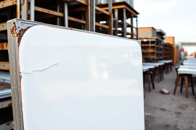
Sun angle decides whether a stucco wall, a porcelain enamel sign face or a neon tube array reads as a documented surface or as a white blob.
Arizona and New Mexico hold the sun high most of the year. Midday light flattens a facade and kills the texture a survey exists to record. The usable windows sit at the edges of the day, when low sun rakes across a wall and shows cracks, patched stucco, rust streaks and repainted panels.
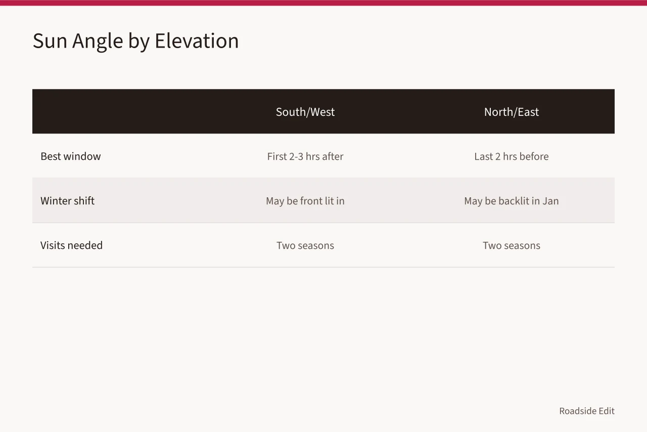
The working rule: south and west elevations in the first two to three hours after sunrise, north and east elevations in the last two hours before sunset. A building set at an angle needs both windows, so plan two visits.
Winter changes the geometry. From November through February the sun tracks lower and further south, so a facade that is backlit in July may be front lit in January. A building that matters gets shot in two seasons.
NOAA publishes the sunrise, sunset and cloud data that make this planning possible. Weather | National Oceanic and Atmospheric Administration is the reference to check before you commit a day.
Thin overcast is useful, not wasted. Even light beats dramatic light for record shots of lettering, hardware and mounting details. Save the hard sun for the hero frames.
On a long corridor, group stops by orientation rather than geography. One morning run along every east facing facade saves fuel and holds the light consistent across the set.
Monsoon season timing along Southwestern corridors
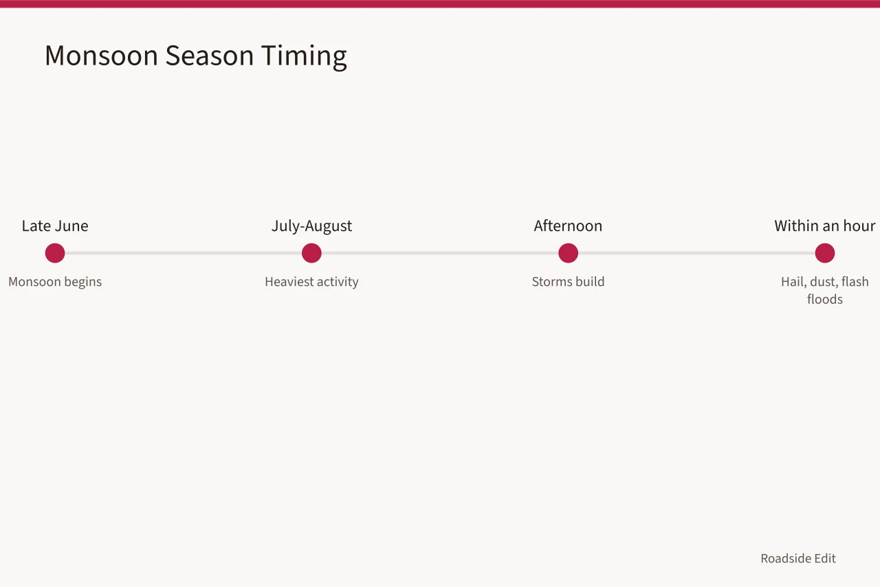
Monsoon season runs roughly late June into September, with the heaviest activity in July and August. Storms build in the afternoon and can drop hail, dust and flash floods inside an hour.
That pattern shapes an itinerary rather than cancelling it. Morning light is often clean, and passing storms scrub the air, which produces the deep blue skies and sharp distant views that make corridor work worth the drive.
Flash flooding is the real risk. A wash that is dry at 9 a.m. can be running bank to bank by 3 p.m. Never park in a wash, a low underpass or a dip in the road, however dry it looks.
Haboobs, the dust walls that roll ahead of storms, cut visibility to near zero. If you see one on the horizon, get off the highway and wait it out. Lightning makes metal signs, poles, fences and abandoned structures unsafe as shelter; a vehicle with the windows up is the retreat.
Keep a storm log: date, the time clouds built, whether the site was shootable afterward. Two or three seasons of notes build a local calendar that beats any general forecast.
For a site that will not survive another summer, the calculation changes. Document before it disappears is the right instinct when a roof is failing and a monsoon is coming.
Heat safety for outdoor survey work
Heat ends more survey days in Arizona and New Mexico than any other constraint, and it is not limited to the desert floor. High elevation sites in New Mexico still reach dangerous temperatures in June.
OSHA treats heat as a serious workplace hazard and publishes guidance on water, rest and shade. Heat - Overview: Working in Outdoor and Indoor Heat Environments | Occupational Safety and Health Administration is the baseline every field team should read before a summer trip.
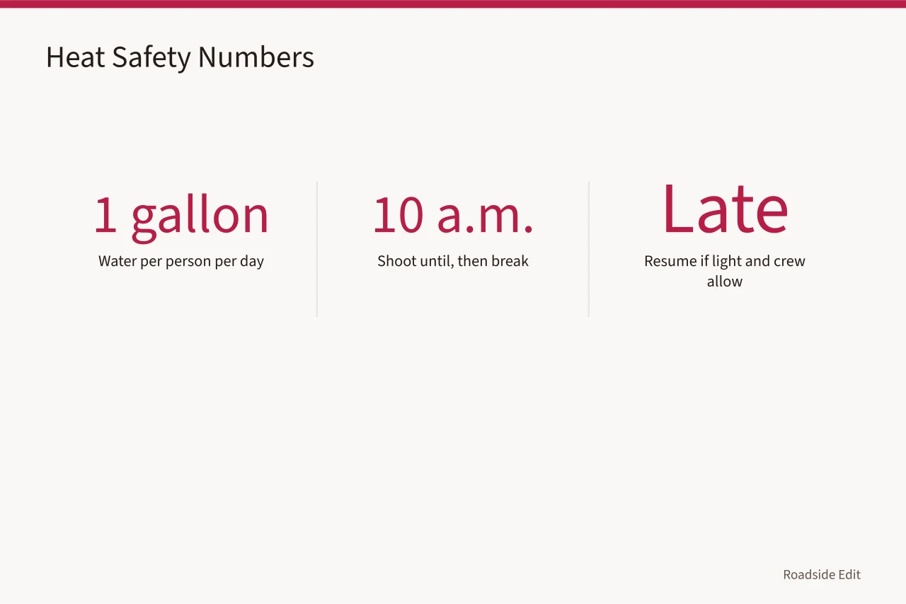
Build the day around the heat. Shoot from first light until about 10 a.m., break through the middle of the day, and resume late if the light and the crew allow it.
Water is not optional and not shared. Carry at least a gallon per person per day, more at low elevation, and drink before thirst arrives. Electrolyte replacement matters on multi-day trips.
Confusion, stopped sweating, headache, nausea and cramping are signs to stop, cool down and call for help. Heat stroke is a medical emergency.
A car parked in the sun becomes an oven. Never leave a person or an animal in it, and never leave film, batteries or electronics on the dashboard.
Some of the best roadside material sits close to the pavement. A surprising amount of gas station preservation is visible from a parked car, which cuts walking time in the worst heat.
Tribal land permission steps before you photograph
Much of the most intact roadside fabric in Arizona and New Mexico sits on tribal land. Photographing there requires permission, and permission is a process rather than a courtesy call.
Start months ahead. Land status is not always obvious from a highway map, so check parcel ownership, tribal boundaries and allotment status before you build a route. A site that looks abandoned may be privately held inside a reservation.
Work through these steps:
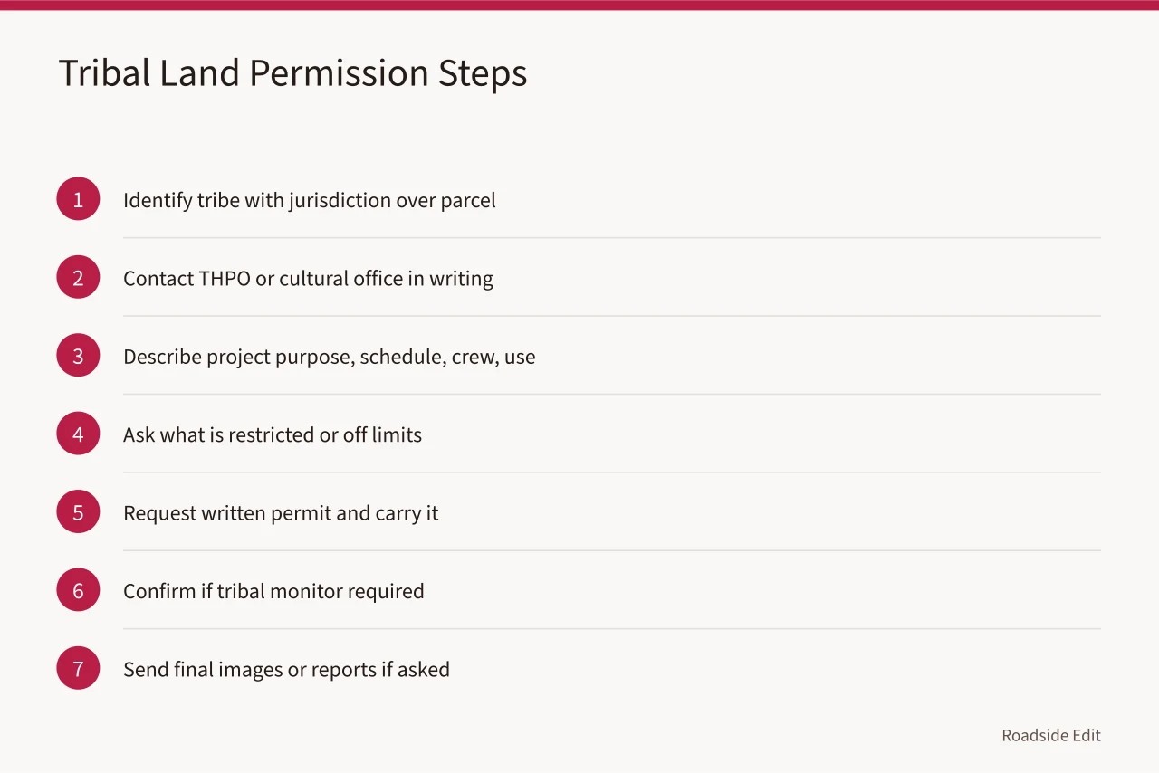
The Advisory Council on Historic Preservation maintains guidance on the consultation relationship. Indian Tribes, Native Hawaiians, and Indigenous Peoples | Advisory Council on Historic Preservation explains what tribes expect from a project.
A public highway right of way does not grant access to adjacent land. Shoulders, frontage roads and fence lines all have owners, and a gate is a boundary whether or not it is locked.
Tribal Historic Preservation Office consultation basics
A Tribal Historic Preservation Office, usually shortened to THPO, is the tribal counterpart to a State Historic Preservation Office. Many tribes in Arizona and New Mexico run one, and it is the correct first contact for survey work on tribal land.
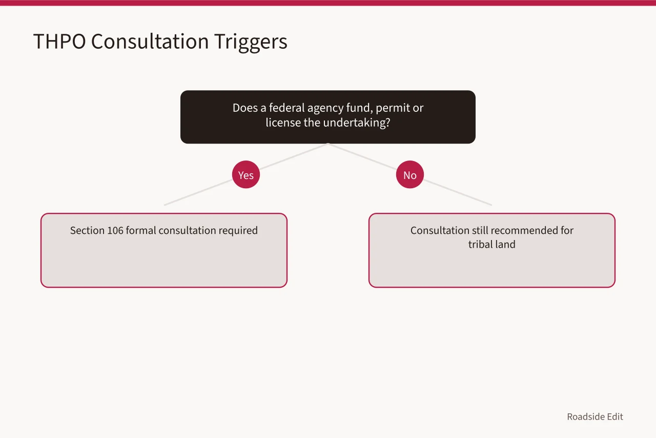
The National Park Service administers the program and explains how a THPO assumes state historic preservation functions on tribal lands. Tribal Historic Preservation Office Program - Historic Preservation Fund (U.S. National Park Service) is the reference for how that authority works.
Consultation is a conversation with a government, not a permit window. Expect questions about purpose, funders, schedule and publication plans, and answer them plainly.
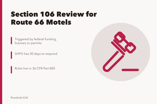
Section 106 of the National Historic Preservation Act triggers formal consultation when a federal agency funds, permits or licenses an undertaking. If a survey supports a federal project, the process is not optional and the timeline belongs to the agency.
Documentation protocols vary by tribe. Some offices want all raw files, some want selected images, and some prohibit photography of certain features entirely. Ask before you shoot.
The Advisory Council on Historic Preservation keeps a digital library of tribal agreements and reference material. Indian Tribes and Native Hawaiians Digital Library | Advisory Council on Historic Preservation shows how other projects handled the same questions.
Build the relationship past one trip. A THPO that knows your work answers the phone next season, and that is worth more than any single permit.
Building a shot list for motels, gas stations and neon
A shot list keeps a survey defensible. It also keeps you from driving four hours and coming home with twelve versions of the same sign.
Start with the building envelope: each elevation, the roofline, the foundation line, any attached canopy or office wing. Then move to the details that date the structure.
For motels, work through the sign, the office, the unit doors and the parking court, then shoot the approach view that shows how the motel sold itself to drivers. For gas stations, capture the canopy, pump islands, office, restroom block and service bay; the relationship between station and road is part of the resource.
For neon, shoot twice. Neon sign restoration work is best recorded in flat daylight, then dusk, because the daytime frame documents the hardware and the dusk frame documents the color. Note tube diameter and transformer count while you are there, since both change with any later replacement.
Use a written checklist in the field:
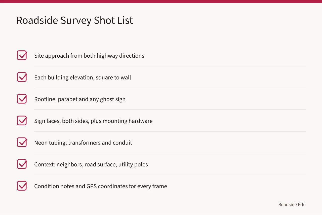
A general frame list helps too. The roadside architecture field list covers the standard twelve frames that make a survey usable by someone who never visits the site.
Label everything the same day. File names, GPS points and condition notes lose meaning fast, and a motel survey with unlabeled images is close to worthless to a preservation office.
If a site is heading into restoration, settle scope, funding and sign control early. The planning questions that decide a motel project are the same habit of asking before you assume.
Common questions
What are sun angle windows?
They are the daily periods when the sun is low enough to rake across a facade and reveal texture. In Arizona and New Mexico that usually means the first two to three hours after sunrise and the last two hours before sunset.
When is monsoon season in Arizona and New Mexico?
It runs roughly late June into September, with the heaviest storms in July and August. Plan field work for the morning and treat afternoon storms as routine.
Do I need permission to photograph on tribal land?
Yes. Contact the Tribal Historic Preservation Office or the tribal cultural office in writing, describe the project, and get a written permit or letter before you arrive.
Can I shoot from a public highway without permission?
You can usually photograph from a public right of way, but you cannot enter adjacent land, cross fences or assume a shoulder is public. Check ownership before you stop.
How long does tribal consultation take?
It varies by tribe and project. Start at least two to three months ahead, and longer if a federal agency or Section 106 review is involved.