Guides
How to plan a roadside renovation that adapts to each region
Use this 2027 roadside renovation regional guide to frame weather, water, heat, wind, access, and local review questions without making site-specific claims.
What to take away
- Begin with local hazard context, but do not treat a regional resource as an address-level answer.
- Plan a roadside renovation that adapts to each region with named sources: FEMA Map Service Center flood panels, NOAA NCEI climate normals, USGS National Map elevation and hydrology, and USDA Plant Hardiness Zone Map data.
- Separate recurring weather patterns from a current observation at the property.
- Separate water, heat, wind, winter, and fire questions into distinct tracks. Keep access questions in a separate track.
- Label every public statement as historical context, a proposal, a documented condition, or a confirmed project update.
- Refresh named sources before publication when FEMA panels, NOAA normals, USDA zones, or local plans change.
- Call the local floodplain administrator, state DOT district permit office, and city or county planning desk before design.
A roadside property in the United States is never just a building. It is part of a climate, a travel corridor, a drainage pattern, a local code environment, and a community that experiences weather in specific ways.
A regional guide helps a project team ask better questions before it claims that a particular renovation will solve a particular risk.
This guide is an editorial and planning framework. It does not identify a flood zone, prescribe construction, determine code requirements, or assess a named property. Use current, property-specific records and the appropriate local professionals for those decisions.
Start with FEMA, NOAA, USGS and USDA place data, not a generic climate label
Terms like 'coastal,' 'desert,' 'mountain,' or 'Midwest' are useful shorthand, but none is a complete project brief.
They can hide differences in elevation, drainage, road exposure, vegetation, and storm patterns. They can hide utility reliability, building use, and local regulation.
Record actual location, intended use, known project scope, and source date before using a regional description in an article.
Treat the region as a question set. A coastal route may raise flooding, wind-driven rain, and evacuation communication questions. A hot inland route may raise cooling, shade, water supply, and heat exposure questions.
A northern corridor may raise snow, ice, freeze-thaw cycles, and access questions. A fire-prone area may raise seasonal conditions, smoke, vegetation, and emergency planning questions. The questions are not diagnoses and do not decide the right response.
Add a concrete first pass:
- Pull the FEMA Map Service Center panel for the address and note the panel number and effective date. The map is a screening source, not a property determination.
- Download NOAA NCEI climate normals for the nearest station. Record the station name, period, and distance from the site.
- Check the USGS National Map for elevation, hydrology, and historical imagery. Save the map layers and dates.
- Look up the USDA Plant Hardiness Zone Map zone for the property. Use it for winter minimum temperature context, not for a planting plan.
- Ask the state DOT district office whether the work touches a public right-of-way or needs an MUTCD sign permit.
These steps give a named, dated file for each regional claim.
Build a regional context sheet with FEMA, NOAA, USGS and state DOT rows
Keep one page for each property or project story. It should identify the source, date, hazard category, what the source describes, and what it does not establish.
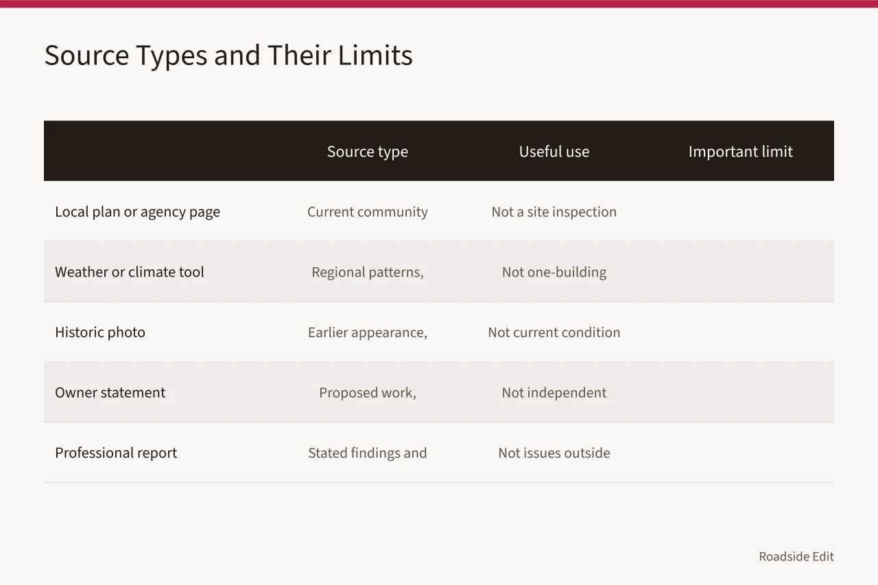
| Source type | Useful use | Important limit |
|---|---|---|
| County comprehensive plan or city public works page | Current community context | Not a site inspection |
| NOAA NCEI climate normals | Regional temperature and precipitation patterns | Not a prediction for one building |
| USGS National Map historical imagery | Earlier appearance or event record | Not current condition |
| Owner statement or sponsor brief | Proposed work or reported status | Not independent confirmation |
| Licensed engineer or architect report | Its stated findings and scope | Not issues outside its scope |
| FEMA Map Service Center flood panel | Flood zone screening and panel date | Not an elevation certificate or property determination |
| USDA Plant Hardiness Zone Map | Winter minimum temperature context | Not a planting or hardiness guarantee |
| State DOT MUTCD permit guidance | Right-of-way sign and access rules | Not a local building permit |
| EPA stormwater BMP menu | Bioretention, permeable pavers, grass swales | Not a site-specific design |
| Local floodplain administrator | Floodplain development permit process | Not a construction approval |
The U.S. Climate Resilience Toolkit explains that buildings and infrastructure may face changing climate conditions. Planning can help decision-makers assess potential impacts over a building's life. Review the toolkit's buildings-and-structures overview.
It does not establish risk, design, or suitability at a particular roadside address. Its lesson is procedural: use planning to understand exposure and choices before presenting an outcome as certain.
Sort water, heat, wind, winter and fire questions by hazard family
Keeping questions separate prevents a regional article from making one broad promise such as 'climate-ready renovation.' That phrase means little unless the record says what issue is being considered and by whom.
Water and drainage
Ask what sources describe local flood, rainfall, runoff, or drainage context; whether the project has current site information; and who is responsible for deciding any work. Do not infer a flood determination from a map, photo, nearby event, or regional article.
For a roadside renovation, pull the FEMA Map Service Center panel and ask the local floodplain administrator whether the parcel sits in a Special Flood Hazard Area. If it does, a floodplain development permit may apply.
Stormwater options include bioretention basins, permeable interlocking concrete pavers, grass swales, and compost filter socks. The EPA National Menu of Stormwater Best Management Practices lists these.
Heat and sunlight
Ask how the property is used, which public-facing areas are affected, what current records say about systems or shade, and whether a proposed change has a defined scope. Do not say a building will be comfortable, cool, or protected without a source that supports the precise claim.
NOAA NCEI normals report cooling degree days and extreme heat counts. ENERGY STAR lists reflective roof products. Light-colored concrete and permeable pavers are common heat-reducing surfaces. Native shade trees matched to the USDA zone cut radiant load.
Wind and storms
Ask which exterior features, temporary work areas, signs, or travel routes need responsible review. A severe-weather context can explain why a project is considering a question. It cannot prove that a particular roof, wall, sign, or tree is sound or unsound.
ASCE 7 hazard tool gives basic wind speed for a site. The MUTCD requires breakaway or yielding supports for many roadside signs. Impact-resistant glazing and hurricane straps are options where wind risk is documented.
Winter weather and freeze-thaw
Ask about the documented use of the property, known access conditions, and the owner's operational plan. Do not turn a regional winter pattern into a claim that a route is accessible or a material will perform in a certain way.
NOAA NCEI normals list snowfall, freezing days, and temperature swings. Air-entrained concrete is common in freeze-thaw climates. Chloride deicers can damage some concrete and roadside vegetation. Check state DOT winter maintenance rules before changing a driveway or access point.
Fire, smoke, and vegetation
Ask whether a local agency or responsible project record defines any issue. Keep public safety language narrow, attributed, and current. General awareness is not an authorization to enter a property, alter a site, or state that a project has mitigated a risk.
Firewise USA and NFPA 1144 provide vegetation and home-hardening guidance. Class A roof assemblies and ember-resistant vents are common in wildfire-prone areas. CAL FIRE and local fire safe councils publish defensible space rules. A burn permit or open-burning ban may apply.
Match the region to a real project stage
The same regional information has different value at different stages. During research it helps writers avoid generic imagery and unsupported claims, and during concept work it helps the project team create a list of questions.
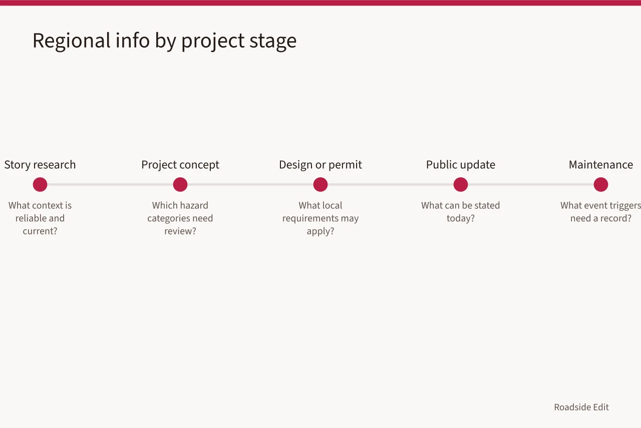
During review it can help identify which local records should be checked. After completion it can help explain why an owner chose a stated approach, but only if the owner or project record confirms that connection.
| Stage | Regional question | Responsible output |
|---|---|---|
| Story research | What FEMA panel, NOAA station, USGS layer and USDA zone are current? | Dated source list |
| Project concept | Which hazard categories need review? | Open-question register |
| Design or permit review | What local requirements may apply? | Floodplain permit, state DOT access permit, ADA curb ramp detail, building permit |
| Public update | What can be stated today? | Attributed, limited copy |
| Maintenance | What event triggers need a record? | Owner-controlled log of NOAA storm events, FEMA map revisions, and local code updates |
| Construction | Which materials suit the documented climate? | Engineered plans for air-entrained concrete, permeable pavers, Class A roof, or impact glazing |
Avoid the false precision trap
Numbers, maps, and forecasts can make a draft sound authoritative even when unrelated to the property.
Do not copy a regional projection into an article and call it the building's future. Do not place a generic hazard map next to an address and imply a determination. Do not use an old disaster story as proof the next event will have the same effect.
The responsible alternative is simple: name the source, say what scale it covers, explain the limited reason it matters to a planning conversation, and identify the next source needed for a project decision. This gives readers real context without borrowing authority from a source that does not support the claim.
Use an elevation certificate, not a FEMA map, to set a lowest floor. Use the NOAA station record, not a nearby city average. Use the USGS National Map scale, not a parcel boundary. Use a licensed engineer for structural or drainage design.
Write regional stories that are useful to visitors
Readers value practical context. For example, a desert roadside business may schedule outdoor events differently in summer, a coastal preservation project may track weather communications, and a snowy-route business may publish a seasonal update.
Tie each statement to a source or attributed business plan. Do not imply a property has made a safety, access, insurance, or code determination.
For paid placements, give sponsors a clear boundary: they may describe their confirmed hours, product, opening, or project statement. They should not turn a regional guide into an unverified claim that their location is fully protected, universally accessible, or approved for a purpose the record does not establish.
Name the source: NOAA Tides and Currents for coastal water levels, NOAA snow normals for a snowy route, or the local NWS forecast office for heat advisories.
Assign a source owner
Give each regional source a named owner, a review date, and a reason it matters. The owner keeps the register current and refers site-specific questions to the appropriate contact; that role does not interpret technical evidence. This prevents an outdated regional report from being treated as a current local decision.
Comparing regions can explain why projects ask different questions, but it should never rank locations as safer or imply that one solution fits all. Describe the contrast at the source's scale, then return to the documented project scope.
Assign the FEMA panel to the floodplain administrator, the state DOT permit to the district office, the building code question to the local building official, and the historic status to the State Historic Preservation Office.
Keep images in their proper role
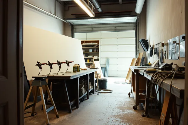
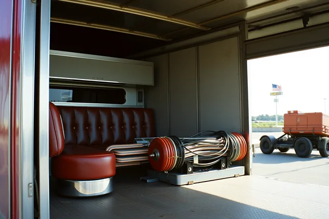
Regional stories often rely on striking photographs. An image can add a sense of place, route history, or seasonal atmosphere, but it cannot prove a current hazard, a building's condition, or a completed improvement.
Caption every image as illustrative unless it is an authorized, dated project record, and include the actual source link and retain the local file. Do not use a media credit as evidence for an unrelated factual claim.
The editorial rule: a source supporting a weather or planning sentence must support that sentence. An image credit must describe the image readers are actually seeing.
USGS National Map imagery carries dates. NOAA photo library images are illustrative. A state DOT photo may show a right-of-way condition on a named date.
Prepare a publication note
Before scheduling, write a short update note with the version date, source-review date, and responsible contact for corrections. Say regional information is context, not a site determination.
This helps articles imported into a CMS long after drafting. It gives a later editor a clear reason to refresh the material, not treat a 2027 guide as permanently current.
Include the FEMA panel effective date, the NOAA normals period, the USDA zone, and the state DOT permit number if one exists.
For a hazard-screening question, the FEMA flood map service is an official starting point, not a property determination. The NOAA climate normals resource supports checking long-term climate context. The USGS National Map provides geographic reference information. Each source should be paired with the appropriate local record before publishing a property-specific statement.
The image is illustrative only and does not describe weather, condition, ownership, or project status at another property.
Keep a revision rhythm
Revisit the context sheet when the property changes use, a proposed scope changes, a local source is updated, a significant event is reported, or an article is scheduled for publication. A regional guide should not age into a site assessment through repetition. It remains useful when it records its limits and points readers toward the current responsible source.
Set calendar checks for new FEMA map panels, NOAA normals updates, USDA zone map revisions, state DOT MUTCD editions, and local code adoption.
Common questions
Can a national climate tool identify risk at one roadside building?
No. It can provide planning context at its stated scale. A property decision requires current, site-specific information and the appropriate review.
Should every regional article use the same hazard categories?
No. Use only the categories that fit the documented local context and the article's purpose.
Can a sponsor claim that its business is climate-ready?
Only if a current, supportable record defines what that phrase means. Otherwise, describe the specific confirmed action or remove the claim.
In this guide
- Before you file a roadside renovation checklist, verify the regional factsRoadside renovation regional checklist for 2027: verify location, map context, climate records, hazard sources, and the limits of every local claim.
- Roadside renovation questions to ask before you publish a regional storyBefore a regional roadside renovation story runs, check the visitor facts and the local code authority so the article states what the public record supports.
- How to compare regional roadside renovation budget notes before you publishRoadside renovation regional budget notes for 2027 help compare local evidence, source dates, climate questions, and labor data without claiming a local price.
- How to build roadside renovation regional adaptation records that lastBuild 2027 roadside renovation regional records that preserve source dates, local context, project limits, weather updates, handoffs, and public corrections.