Guides
Modern roadside design fundamentals: a 2027 guide to arrival, identity and lighting
Modern roadside design fundamentals for 2027 help U.S. owners organize arrival, identity, circulation, materials, lighting, and site-review questions.
Modern roadside design is a coordination problem before it is a styling problem. A visitor needs to understand where to enter, how to move safely, what the place is for, and where to find the next useful point of contact. The building, sign, paving, planting, lighting, and parking should reinforce that sequence instead of competing for attention.
This guide provides a planning vocabulary for U.S. readers. It does not design a site, determine accessibility or code compliance, select materials, establish costs, or approve a project. Local rules, existing conditions, ownership, utilities, traffic, weather, and the history of a place can change every decision.
What to take away
- Begin with arrival and circulation, then consider visual identity.
- Give every element a job: orientation, shade, access, parking, information, or maintenance.
- Distinguish a design intention from a permitted or completed change.
- Record source dates, existing conditions, and open questions before publishing a project claim.
- Treat lighting, planting, paving, and signage as connected site systems rather than isolated purchases.
Start with the visitor sequence
Think about the site as a short sequence of decisions. A person approaches from a street or highway, notices a sign or building form, chooses an entrance, parks or arrives on foot, finds a route, and reaches the door or service point. A roadside place becomes easier to use when this sequence has fewer conflicting cues.
Map the route without assuming every visitor arrives by car. Mark public streets and sidewalks, vehicle entries, pedestrian paths, and loading areas. Note parking, bicycle storage if present, entrances, outdoor waiting areas, and separate buildings.
Then mark points where a visitor might hesitate: a poorly placed sign, an unmarked turn, a dark walk, or an unclear door. These can frustrate use of a visually appealing site.
| Sequence point | Useful design question | Record to keep |
|---|---|---|
| Approach | What can a first-time visitor recognize from the street? | Dated street-view or site photo |
| Arrival | Where do vehicles, pedestrians, and deliveries enter? | Sketch of observed paths and conflicts |
| Orientation | What confirms the right entrance or service point? | Sign inventory and location notes |
| Movement | Which routes are visible, continuous, and maintained? | Route notes and open questions |
| Pause | Where can someone wait, rest, or read information? | Existing-feature record |
| Departure | Can a visitor leave without crossing an unclear path? | Circulation diagram and later correction log |
Give visual identity a real job
Visual identity should help a person recognize a place and understand its purpose. It may be expressed through sign placement, a canopy, a color family, a material rhythm, window patterns, planted edges, or an information panel. The right choice depends on what is already present and what a site needs to communicate.
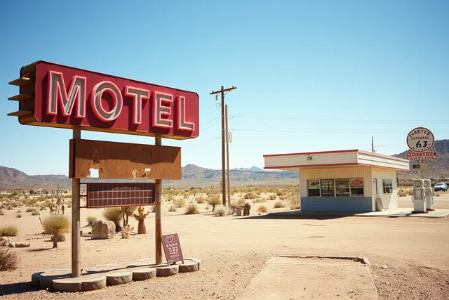
The National Park Service describes early roadside architecture that was designed to catch the attention of passing motorists. Read the NPS roadside-attractions lesson. That historical context does not prescribe a new sign or facade. It does show why visibility and recognition have long mattered on automobile-oriented corridors.
Before proposing an identity element, write down its purpose. Is it helping a visitor find the entrance? Is it distinguishing a business from adjacent driveways? Is it carrying required information? Is it preserving a documented feature? Or is it simply decorative? A single purpose is easier to test than a vague request to make a property look more modern.
| Element | Helpful role | Common overreach to avoid |
|---|---|---|
| Sign | Identifies a location or action point | Treating a visual concept as a permit approval |
| Canopy | Marks arrival and provides weather transition | Assuming it resolves every accessibility issue |
| Color | Creates a legible family across features | Calling a color historic without a source |
| Planting | Frames edges, shade, and views | Promising performance without a maintenance plan |
| Paving | Defines routes and uses | Naming a material without site or drainage evidence |
| Lighting | Supports visibility at selected times | Equating more light with better safety |
Separate the systems
Roadside projects get expensive or confusing when systems are handled separately late. Paving choices affect planting space and drainage. Lighting locations affect poles, wiring, signage, trees, and maintenance access.
A sign may affect sight lines, adjacent circulation, and entrance clarity. A new path may require coordination with parking, slopes, curbs, and the building threshold.
Make a simple coordination table early. It does not need technical dimensions. Its job is to show where one decision depends on another and which question needs current local review.
| System | First planning question | Linked systems |
|---|---|---|
| Arrival route | How does a person reach the intended entrance? | Parking, paths, signs, lighting |
| Signage | What action or place does each sign identify? | Sight lines, street edge, lighting |
| Outdoor surface | Which use occurs here and what condition is known? | Drainage, planting, route continuity |
| Lighting | What needs visibility and at what time? | Electrical access, maintenance, neighbors |
| Planting | What edge, shade, or orientation role does it serve? | Soil, paving, irrigation, maintenance |
| Building edge | How does the facade support arrival and wayfinding? | Doors, canopies, signs, route |
Do not fill unknowns with assumptions. A planning table can say "drainage information not reviewed" or "route slope needs local assessment." That makes the eventual handoff more useful than a confident but unsupported design sentence.
Design for different kinds of arrival
Car-oriented places still have pedestrians, passengers, workers, delivery drivers, neighbors, and people using mobility devices. Their paths may overlap, but they do not have the same needs. A site plan should distinguish them before a rendering hides the conflicts.
Start by documenting the existing arrival points. If a sidewalk, public transit stop, passenger loading area, accessible parking, or public street connects to the site, record it. If the site has only vehicle access in the available material, say that too. The record should not claim compliance or noncompliance. It should identify the routes that require the next review.
Use materials as evidence, not marketing
Materials are often described with adjectives such as durable, low-maintenance, cool, permeable, or sustainable. Those words can be useful only when their conditions are stated. A material may perform differently because of climate, installation, maintenance, traffic, exposure, soil, water, local availability, or the rest of the site system.
Instead of "permeable paving will solve drainage," ask: What site, soil, water, maintenance, and local-review details are needed before a permeable-paving decision?
Instead of "new planting will shade the lot," name the planting goal, available space, maintenance role, and documentation time frame.
This language is less dramatic, but it is more durable. It helps a reader distinguish an aspiration from a verified project result.
Make lighting purposeful
Lighting can serve arrival, direction, task visibility, identification, and selected exterior activity. Begin by naming the task and time period instead of choosing a fixture. For example, an entry threshold, walking route, parking transition, service area, or sign may each have a different reason for lighting.
Document what exists and what is not known: fixture locations, visible outages, controls if documented, power source assumptions, adjacent residences, and maintenance access. A photograph can show the appearance of a light at one moment. It cannot establish light levels, electrical condition, security, or code status.
Keep a design-intent record
The NPS standards for architectural documentation call for reliable sources and clearly stated limits. Use that principle when an early design record is turned into an article. A dated image can identify what it shows. A concept can identify what it proposes. The article should not switch either one into a claim of approval or completed work.
The Access Board guide to accessible routes describes connections from arrival points to accessible entrances. It can help a team identify which routes deserve current documentation. It does not decide whether any particular property meets current requirements.
The National Archives guidance for digital photographs supports keeping identifying information with the source image. Record the file ID, date, depicted location, and caption in the editorial source register. A media credit describes the image origin and should not do the work of a factual citation.
A design-intent record is a plain-language bridge between early ideas and later decisions. Give each proposed change a feature, purpose, source, status, and next question. Keep proposed, approved, and completed in separate status fields. If an owner changes direction, add a dated revision rather than overwriting the old record.
This record is especially useful when a future article includes a business profile or sponsored placement. The business can describe its own services, but its statement should not become a factual claim about the site without a relevant source. Clear labels protect readers and create a cleaner editorial boundary.
A practical first review
Before publishing a modern-roadside-design article or starting a broad search for help, ask:
- What does a first-time visitor need to understand in the first minute?
- Which routes, entries, signs, and edges are supported by current observations?
- Which details are historical context, current condition, proposal, or completed work?
- Which system interactions have not been assessed?
- Which local authority, owner, or qualified reviewer needs to answer the remaining question?
- Are any claims about cost, performance, approval, or safety stronger than the source beside them?
The goal is not a uniform roadside look. It is a place whose cues, routes, and records work together clearly enough for the next decision.
Common questions
Does modern roadside design mean replacing older features?
No. A modern approach can improve clarity, maintenance, and visitor experience while documenting and considering existing features first.
Can a general design guide confirm local compliance?
No. General guidance can frame questions. Local requirements and property-specific conditions need their own current review.
Should a business listing be treated as project evidence?
No. Label a listing or paid placement by its commercial role. Use a relevant record for factual project claims.